
As an avid traveler, I have always been drawn to destinations that offer a unique blend of natural beauty, cultural heritage, and stunning landscapes. One such place that has captured my heart is the enchanting island of Kefalonia. Located in the Ionian Sea, Kefalonia is the largest of the Ionian Islands and is known for its crystal-clear waters, picturesque beaches, and charming villages. In this article, I will take you on a virtual tour of Kefalonia and show you how a Greek Islands map can be your best companion when exploring this mesmerizing island.
Understanding the Greek Islands
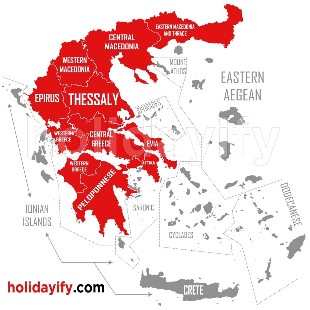
Before we dive into the specifics of Kefalonia, let’s first gain a general understanding of the Greek Islands. Greece is home to a vast archipelago comprising more than 6,000 islands and islets, of which only 227 are inhabited. These islands are divided into several groups, with the most well-known being the Cyclades, the Ionian Islands, and the Dodecanese. Each group has its own unique charm and attractions, making Greece a paradise for island-hopping enthusiasts.
Exploring Kefalonia’s Geography
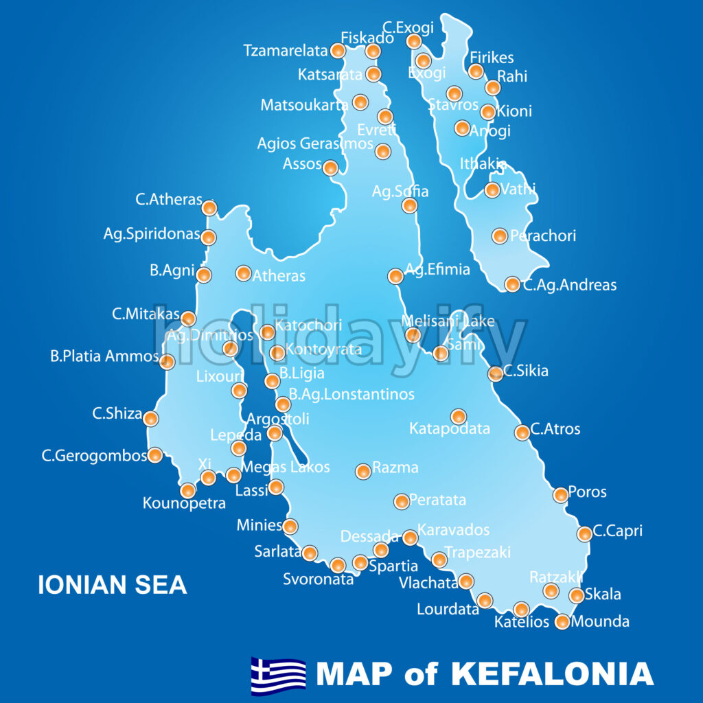
Kefalonia, also known as Cephalonia, is situated in the Ionian Sea, southwest of mainland Greece. It is approximately 50 kilometers west of the mainland city of Patras. The island spans an area of 786 square kilometers, making it the largest of the Ionian Islands. Kefalonia is renowned for its rugged coastline, dramatic cliffs, and lush green landscapes. Its diverse geographical features include mountains, caves, and underground lakes, offering a plethora of opportunities for outdoor exploration.
Where is Kefalonia on the Map?
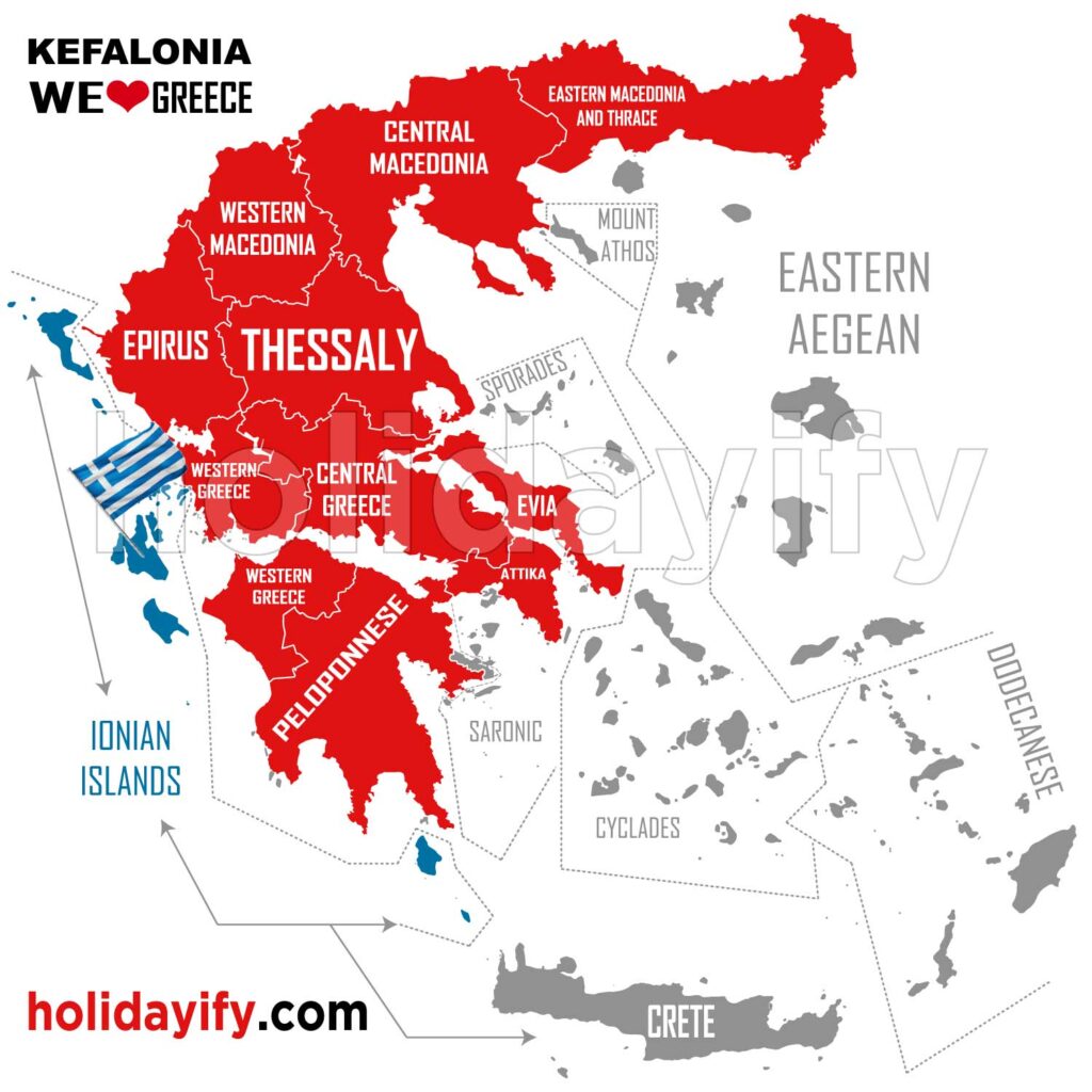
To locate Kefalonia on a map, one must look to the western part of Greece. The island is situated west of the mainland and east of the island of Zakynthos. Its coordinates are approximately 38.175°N latitude and 20.569°E longitude. When planning a trip to Kefalonia, it is helpful to have a detailed Greek Islands map that clearly highlights the location of the island, allowing you to plan your travel route and explore nearby attractions with ease.
Best Beaches in Kefalonia Island on Map
One of the main attractions of Kefalonia is its stunning beaches. From secluded coves to expansive sandy shores, Kefalonia offers a beach experience to suit every preference. Myrtos Beach, located on the northwest coast of the island, is often hailed as one of the most beautiful beaches in Greece. With its turquoise waters and white pebble shoreline, it is a true paradise for beach lovers. Other notable beaches include Antisamos Beach, Xi Beach, and Skala Beach, each offering its own unique charm and allure.
Navigating Kefalonia’s Resorts
When visiting Kefalonia, it’s essential to have a good understanding of the island’s resorts and their locations. The northern part of the island is home to popular resorts such as Fiskardo and Assos, known for their picturesque harbors and traditional architecture. In the south, you will find the vibrant resort town of Lassi, which boasts stunning views of the Ionian Sea. Argostoli, the capital of Kefalonia, is also worth a visit, with its charming waterfront promenade and bustling central square. By referring to a Greek Islands map, you can easily navigate between these resorts and plan your stay based on your preferred locations and attractions.
Using a Greek Islands Map to Plan Your Trip
A Greek Islands map is an invaluable tool when planning your trip to Kefalonia. It allows you to visualize the proximity of the island to other Greek destinations, such as Zakynthos and Ithaca, enabling you to incorporate island hopping into your itinerary. Additionally, a detailed map will help you identify the best routes to reach Kefalonia, whether you are traveling by air, sea, or land. By studying the map, you can also discover lesser-known gems and hidden spots that may not be as widely publicized, ensuring a unique and authentic experience on the island.
Kefalonia Map in English: Essential Phrases and Terms
To fully utilize a Greek Islands map, it is important to familiarize yourself with essential phrases and terms in English. Here are a few key words that will come in handy when using a Kefalonia map:
- North: Βόρεια (Voreia)
- South: Νότια (Notia)
- East: Ανατολικά (Anatolika)
- West: Δυτικά (Dytika)
- Beach: Παραλία (Paralia)
- Resort: Θέρετρο (Theretro)
- Harbor: Λιμάνι (Limani)
- Capital: Πρωτεύουσα (Protevusa)
By familiarizing yourself with these terms, you can easily navigate the map and communicate with locals during your visit to Kefalonia.
Tips for Exploring Kefalonia with a Map
To make the most of your Kefalonia adventure with the help of a Greek Islands map, here are a few tips to keep in mind:
- Plan your itinerary: Study the map beforehand and identify the attractions and areas you wish to explore. This will help you make the most efficient use of your time on the island.
- Rent a car: Kefalonia is best explored by car, as it allows you to reach remote beaches and hidden villages. Use the map to navigate the island’s road network and plan your routes accordingly.
- Seek local recommendations: While a map is a great resource, don’t be afraid to ask locals for their favorite spots and hidden gems. Their insider knowledge can enhance your experience and lead you to off-the-beaten-path treasures.
Conclusion: Unveiling the Beauty of Kefalonia
In conclusion, Kefalonia is a true gem among the Greek Islands, offering a perfect blend of natural beauty, rich history, and warm hospitality. By utilizing a Greek Islands map, you can navigate the island with ease, discover its breathtaking beaches, explore charming resorts, and uncover hidden treasures along the way. So, pack your bags, grab a map, and get ready to embark on an unforgettable journey as you unveil the mesmerizing beauty of Kefalonia.


